
Surveys
DJC.COM
July 28, 2005
A road map for Columbia Basin's future
Adolfson Associates
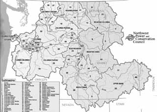
Image courtesy Northwest Power and Conservation Council
There are 62 subbasins within the Columbia River Basin. Click here to view a larger photo.
|
Natural resource management in the Columbia River Basin has reached an important milestone with the adoption of nearly 60 subbasin plans. These plans will help to direct millions of dollars in funding toward fish and wildlife enhancement projects throughout the Columbia River Basin.
The Northwest Power and Conservation Council — with representation from Oregon, Washington, Idaho and Montana — has adopted all of these subbasin plans.
Under the direction of the Northwest Power Act of 1980, the council is implementing a program to protect and enhance fish and wildlife of the Columbia River Basin that have been affected by hydropower dams, while ensuring the region an adequate, efficient, economical and reliable power supply.
The Bonneville Power Administration, which funds the council's Fish and Wildlife Program, directs the expenditure of about $140 million annually to support enhancing aquatic and terrestrial habitat and fish and wildlife populations throughout the basin.
New review process
The council is working with others throughout the Columbia Basin to develop a new comprehensive project review process to fund and implement the strategies set forth in the subbasin plans. The council's recommendations will guide review of projects beginning in 2007.
The subbasin plans were developed by a variety of locally based entities that followed technical guidance developed by the council. Local governments, watershed councils, and state, federal and tribal agencies spent nearly two years developing the plans. Each plan describes historical and existing fish and wildlife habitats and populations, inventories past projects and accomplishments, and provides a management plan that outlines projects 10 to 15 years into the future.
The subbasin plans provide Columbia Basin watershed councils and other stakeholder groups with a road map for restoring habitat. The plans provide a strategy for restoration over large areas where land uses are complex and multiple organizations are involved. For example, in the lower Columbia Basin, Oregon's Willamette subbasin encompasses more than 11,000 square miles, has a growing urban population and has a wide variety of local groups working on habitat restoration. The plan, coordinated by the Willamette Restoration Initiative, describes broad strategies for improving the subbasin's habitats. Watershed councils and other local entities are using the plan as a framework for prioritizing action plans and funding proposals for restoration projects in specific watersheds.
In the sparsely populated and more arid upper Columbia Basin, the subbasin plans provide a scientific foundation for understanding how habitat modification, water use patterns, grazing and other land management actions affect fish and wildlife.
The Grande Ronde plan, for instance, covers 4,000 square miles of eastern Oregon and Washington. The plan was prepared by the 14-member Grande Ronde Model Watershed, which has representation from local, state, federal and tribal governments, plus private interests. The plan's summary of habitat conditions is guiding the model watershed program's implementation of site-specific habitat restoration projects.
A boost for fish, wildlife
NOAA Fisheries and the U.S. Fish and Wildlife Service may use subbasin plans as a component of Endangered Species Act recovery planning. State and federal agencies may use the plans to revise hatchery and harvest goals and to complete an integrated monitoring and evaluation framework for fish and wildlife projects and research.
The Lower Columbia Fish Recovery Board and the Washington Department of Fish and Wildlife used information developed through subbasin planning, and other processes, to help draft the region's first locally developed salmon recovery plan. The plan aims to restore five species of salmon as well as other fish to healthy, harvestable levels during the next 25 years. It encompasses areas on the lower Columbia River as well as 18 major and a number of lesser tributary basins in Clark, Cowlitz, Lewis, Skamania, Wahkiakum, and portions of Pacific and Klickitat counties in southwest Washington.
The Lower Columbia Fish Recovery Board, created in 1998, represents a broad-based local forum for development of the plan. Information on Washington's lower Columbia salmon recovery plan can be found at www.lcfrb.gen.wa.us.
The adopted subbasin plans and other information on the process are posted at www.nwcouncil.org/fw/subbasinplanning.
John Runyon is watershed program manager at Adolfson Associates. He specializes in the design and implementation of watershed assessments and habitat restoration project planning.
Other Stories:
- Green buildings can spark economic growth
- Whitewater parks move into the mainstream
- Momentum is building to reduce global warming
- Turning waste into environmental, social good
- Let the sunshine in, efficiently
- The hazards of flicking on a light switch
- Canada: A lesson in salmon recovery planning
- Better mapping may change development rules
- What makes a green consumer?
- Farmers, government team up to save fish
- Seattle law firms end their paper chase
- Food industry puts energy efficiency on the menu
- A solution to Hood Canal's lurking pollution?
- Stretching Washington's water supply
- Saving salmon: Now the hard work begins
- Seattle finds gold with sustainable strategies
Copyright ©2009 Seattle Daily Journal and DJC.COM.
Comments? Questions? Contact us.