|
Subscribe / Renew |
|
|
Contact Us |
|
| ► Subscribe to our Free Weekly Newsletter | |
Construction Bids
| home | Welcome, sign in or click here to subscribe. | login |
|
Finding the way to the future in the city�s open spaces Connections and places will provide an urban design framework for the center of the city
By JOHN RAHAIM Seattle, like many American cities, is in search of itself. This has become a local clich�, and in spite of local perception, it is a national phenomenon. But here, perhaps more than any other city in America, there is a particularly acute form of civic angst: Seattle seems to want to be a big city, while retaining all of the small town characteristics it has cherished for years. Why can�t we grow and still be Seattle? The answer, of course, is that we can-but it will not happen simply by building dozens of new buildings and hoping for the best.
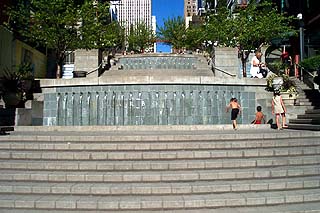
When one thinks of the world�s great cities, what comes to mind more often than the architecture are the great streets and open spaces, those inherently public spaces that truly define great urban places. But just as important as the great civic places are the myriad of neighborhood streets and open spaces that are interwoven to form special places throughout the city. Rome is not only defined by Piazza Navona and the Roman Forum, but by a myriad of piazze and warrens of pedestrian streets. These spaces are so comfortably interconnected and interwoven, that the experience of getting to the great civic spaces is as satisfying as the actual arrival. Seattle does indeed have its defining public places. Pike Place Market and Elliott Bay characterize this city in an extraordinary way. Like many great cities, both are truly public. But what of the experience to get to the Market or the Bay? How are these places, arguably Seattle�s heart and soul, connected to and available from other parts of the city? If connections are the goal, the public realm must be designed. The public realm is the civic space we all share, defined in the city by streets, open spaces and the buildings that front them. The design of the public realm, and its relationship to public and private development, is what we call urban design. The Center City Urban Design Strategy is the focus of this effort. Called Connections and Places, the strategy will provide a comprehensive Urban Design framework for the Center City-downtown Seattle and the ring of neighborhoods that are increasingly interdependent on downtown. Organized as a special project of CityDesign, the City�s new office of Urban Design, the Urban Design Strategy is being conducted partly in response to neighborhood planning groups, who recognized the need for a comprehensive approach to downtown planning and design in their neighborhood plans. A critical component of Connections and Places is an open space plan for center of the city. The Open Space Plan will be a tool to guide the creation of an open space system for downtown, involving key streets, gathering places and parks. The combined center city neighborhoods are expected to accommodate 65 percent of the city�s household growth and 56 percent of the city�s employment growth by the year 2014. Given the densities of these neighborhoods, desirable to protect rural land, there is little private open space possible. The need for high quality public space, in an integrated system, is increasingly clear.
The Open Space Plan will develop a program for center city open spaces much like a developer prepares a program for a building. However, unlike the developer with a finite set of users and needs, the open space plan must accommodate a variety of users in a setting that is public by definition. The great advantage of looking at the entire system, rather than individual spaces, is that the program can be fulfilled in a variety of locations and forms, not just one. And just like those streets in Rome which connect to the great public spaces, the streets of Seattle can be incorporated into the plan as an integral part of the open space system. The Open Space Plan will answer these types of questions:
It has become a clich� to say that Seattle is at a crossroads, that the opportunity "is now" to make a difference for future generations. The fact remains that the city must capitalize on the current energy to truly create a livable big city in the 21st century. An open space plan is a piece of a planning and design strategy for the city that will help to define the future direction of the city for decades. Nowhere is the need clearer, and the opportunity greater, than on the central waterfront. The 1987 Harborfront Plan guided public and private decisions on the waterfront for the past decade and a half. Port and State decisions for transportation and tourism activities were laid out, and the overall use pattern of the central waterfront was established in the plan. The next logical step in that plan, as with the Downtown Land Use and Transportation Plan of 1985, is an urban design and open space plan. Such a scheme would illustrate not only where public access should occur on the waterfront, but how. Had such a strategy been in place, the current debate about the siting of the Aquarium, and the potential impact on waterfront open space, would be understood and addressed. The importance of the plan, and commitment to its implementation, cannot be overestimated. One hundred and fifty years ago, many New Yorkers were outraged at the notion of reserving hundreds of acres of land for an undeveloped open space. Today, New York is unthinkable, and would likely be unlivable, without Central Park. Seattle is not New York and probably does not need a Central Park. But it clearly does need comparable attention to those places, inherently public, that define the real heart and soul of a great city.
John Rahaim is the executive director of CityDesign, the city�s new office of Urban Design.
|